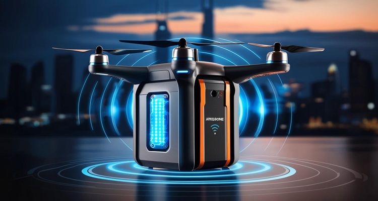
Future of Drone Detection Radar: AI, 3D Tracking & Smart City Integration
The rapid expansion of unmanned aerial vehicles (UAVs), or drones, has transformed surveillance, logistics, and defence operations worldwide. However, their misuse for espionage, smuggling, or attacks on infrastructure has created new airspace security challenges. Conventional air defence radars, designed for large aircraft, are ineffective against low-altitude, low-radar-cross-section (RCS) micro and mini drones.
The solution lies in advanced Drone Detection Radar (DDR) integrated with AI-driven analytics, 3D tracking, and networked counter-drone systems. These innovations are now critical for both military and civilian infrastructures, including airports, borders, and smart cities.
At Kotai Electronics Pvt. Ltd., our mission is to engineer radar-based anti drone systems tailored for Indian terrain, weather, and operational environments — combining indigenous hardware with AI-enhanced situational awareness.
Evolution of Drone Detection Radar Technology
Limitations of Conventional Radar
Traditional air surveillance radar operates in S or L bands with long-range detection but limited resolution for small, slow-moving drones. Their pulse repetition frequency (PRF) and antenna gain are optimised for high-speed targets, not small quadcopters flying at 30–50 km/h or hovering.
Additionally, conventional systems suffer from:
- Low RCS returns (micro drones ~0.01–0.05 m²).
- Ground clutter interference in urban areas.
- Inadequate Doppler discrimination for propeller micro-Doppler signatures.
These limitations created the need for specialised short-range, high-resolution radar with AI-supported classification capabilities.

Next-Generation Architecture of Drone Detection Radar
Modern Drone detection radar systems follow a multi-layered architecture designed for scalability, rapid deployment, and interoperability with electronic countermeasures.
1. Core Functional Layers
| Layer | Function | Typical Technology |
|---|---|---|
| Detection Layer | Detects drone presence using FMCW or pulse-Doppler radar. | X-band or Ku-band radar sensors; digital beam forming. |
| Tracking Layer | Maintains 3D tracking (range, azimuth, elevation). | Multi-target tracking with Kalman filters; track-while-scan algorithms. |
| Classification Layer | Differentiates drones from birds or clutter. | AI-driven micro-Doppler analysis and pattern recognition. |
| Decision Layer | Prioritises and interfaces with jammers or mitigation systems. | Command and control software; threat scoring and fusion engine. |
2. Frequency Bands
Most Drone detection radar systems operate in X-band (8–12 GHz) or Ku-band (12–18 GHz) because of their favourable balance between range, resolution, and antenna size. These frequencies effectively detect drones with RCS below 0.05 m².
3. Signal Processing & AI Integration
Micro-Doppler analysis allows radar to read propeller rotation frequencies, helping AI classify flying objects as drones, birds, or clutter. Machine learning models trained on radar spectrograms can:
- Detect hovering drones.
- Estimate drone type and flight behaviour.
- Filter out false alarms caused by birds or vegetation.
At Kotai Electronics, our R&D integrates deep learning-based radar signature classifiers optimised for Indian environmental datasets — improving accuracy in humid, dusty, or foggy conditions.
4. Role of AI and Machine Learning
1. AI in Signal Classification
AI enables real-time pattern recognition in radar returns. Convolutional neural networks (CNNs) and recurrent networks (RNNs) are trained on drone micro-Doppler spectrograms to distinguish between drone types or reject false targets.
2. Adaptive Thresholding
Traditional Constant False Alarm Rate (CFAR) detectors use static thresholds. AI-driven adaptive CFAR dynamically adjusts detection parameters based on clutter conditions, improving performance in urban and coastal regions.
3. Predictive Tracking
Reinforcement learning models can anticipate drone trajectories and optimise sensor orientation. This is useful for swarm scenarios where multiple drones appear simultaneously.
4. System Learning Loops
Kotai Electronics’ design philosophy includes continuous model learning — radar systems log encounters and retrain classifiers locally or via secure cloud channels, keeping detection models up-to-date against new drone designs.

3D Tracking and Spatial Awareness
Traditional 2D radars provide only range and azimuth. 3D radar adds elevation measurement, critical for precise localisation and engagement.
1. Digital Beam Forming (DBF)
Using electronically controlled antenna arrays, DBF enables vertical scanning without mechanical tilt. This allows the radar to simultaneously track drones at different altitudes — ideal for city environments with variable building heights.
2. Track-While-Scan (TWS)
3D Drone detection radar uses TWS algorithms to maintain multiple drone tracks while continuing to search for new targets. This is essential for swarm scenarios.
3. Output Interface
The radar’s 3D positional data feeds a central command dashboard via secure Ethernet or fibre, displaying real-time threat maps. Integration with optical/IR sensors enables auto-cueing for visual confirmation.
Multi-Sensor Fusion: Building Complete Counter-Drone Systems
Radar is only one layer of a comprehensive anti drone ecosystem. True resilience comes from sensor fusion, where radar data is combined with other modalities:
| Sensor Type | Function | Advantages |
|---|---|---|
| Electro-Optical/Infrared (EO/IR) | Visual confirmation and target ID. | Provides evidence for decision-making. |
| RF Detectors | Identify drone communication frequencies. | Detects even before radar contact if drone is transmitting. |
| Acoustic Sensors | Detect rotor noise at close range. | Useful in low-visibility environments. |
| AI-Driven Fusion Engine | Correlates radar, RF, and EO data. | Reduces false positives, enhances accuracy. |
Kotai Electronics integrates multi-sensor fusion via our modular platform that supports plug-and-play sensor input — allowing real-time synchronisation and centralised threat evaluation.
Smart City Integration
1. The Need for Urban Airspace Security
India’s smart city mission introduces interconnected infrastructure — IoT, surveillance, and transport automation. However, drones pose risks to airports, metro stations, power plants, and public events.
2. Integration Architecture
Drone detection radar can be connected to city command centres through existing fibre or 5G networks. The radar’s data feed merges with CCTV and IoT systems, forming an urban airspace security layer.
3. Real-Time Command Systems
Integration enables:
- Automated alerting to police or security agencies.
- Geo-fencing enforcement, preventing drones from entering restricted zones.
- Event-specific deployment, such as during VIP movements or mass gatherings.
4. Data-Driven Governance
AI-based analytics can correlate drone data with ground activities, improving response strategies and supporting forensic investigations after incidents.
How to Make a Radar – Engineering Blueprint
For R&D or procurement teams exploring indigenous radar development, the following simplified engineering roadmap outlines key design principles.
- Define Operational Scenario
- Range: 0.5–5 km typical for DDR.
- Drone RCS target: 0.01–0.1 m².
- Altitude coverage: up to 1 km.
- Select Radar Architecture
- FMCW radar preferred for short-range, high-resolution operation.
- X/Ku band antennas for balance between beamwidth and cost.
- Design Antenna System
- Planar phased array or microstrip patch array.
- Use digital beam forming to enable 3D scanning.
- Develop Signal Processing Chain
- Implement pulse compression, FFT processing, and Doppler filtering.
- Include micro-Doppler extraction for rotor blade signature detection.
- Integrate AI Module
- Train neural networks on diverse drone types using labelled radar data.
- Deploy models on embedded GPUs or edge AI hardware.
- Interface with Counter-Measure Systems
- Use standard communication protocols (TCP/IP, Modbus, CAN) to connect with RF jammers, net guns, or laser neutralisers.
- Testing & Calibration
- Validate detection under varying humidity, temperature, and terrain.
- Calibrate CFAR and clutter suppression algorithms for Indian atmospheric conditions.
This modular “how to make a radar” framework can support defence and industrial R&D teams in building cost-effective indigenous systems.

Indian Ecosystem and Market Outlook
1. Growing Defence and Civil Demand
According to open-source data from ORF and IDSA, drone incidents along the India–Pakistan border and near airports have increased sharply since 2020. This has accelerated government initiatives to deploy counter drone systems nationwide.
Public sector organisations such as BEL (Bharat Electronics Ltd.) already field 3D Drone Detection Radar systems capable of 360° coverage and EO integration. Private firms like Kotai Electronics Pvt. Ltd. are complementing this effort with AI-enhanced, modular systems designed for both defence and civilian use.
2. Policy Support
Under “Atmanirbhar Bharat” and “Make in India”, indigenous radar manufacturing is receiving R&D funding and procurement preference, encouraging local production and reducing dependence on imports.
3. Application Sectors
- Border Security Forces – detecting cross-border drone incursions.
- Airports and Seaports – monitoring unauthorised aerial activity.
- Critical Infrastructure – nuclear plants, refineries, power grids.
- Smart Cities – integrating drone detection with existing CCTV/IoT layers.
Challenges & Research Directions
| Challenge | Research Focus |
|---|---|
| Low RCS drones | Use of MIMO radar and AI-based signature enhancement. |
| Swarm detection | Cluster tracking algorithms and 3D correlation. |
| Stealth UAVs | Multistatic radar configurations and passive sensing. |
| Weather interference | AI-based adaptive clutter filtering. |
| Cost optimisation | Hybrid analog-digital beamforming and edge computing. |
Kotai Electronics collaborates with research partners to address these issues through algorithmic innovations and indigenous hardware development.
Kotai Electronics’ Strategic Direction
As a leading Indian developer of intelligent transportation and security systems, Kotai Electronics Pvt. Ltd. is expanding its radar portfolio to include:
- AI-Enabled Drone Detection Radar with micro-Doppler classification.
- Portable 3D Radar Units for border and tactical deployment.
- Integrated Counter-Drone Platforms with EO/IR, RF detection, and neutralisation modules.
- Smart City-Compatible Systems for automated airspace security.
Our radar systems are designed to operate seamlessly within larger security architectures — compatible with existing CMS dashboards, IoT devices, and central command networks.
Conclusion
The future of drone detection radar lies in convergence — AI-based signal intelligence, 3D spatial tracking, and full integration with smart urban and defence infrastructures. India’s security environment demands indigenous, adaptive, and modular systems capable of identifying and neutralising drone threats in real time.
By fusing radar innovation with software intelligence, Kotai Electronics Pvt. Ltd. is building the next generation of drone detection systems in India — empowering defence forces, law enforcement, and smart cities with advanced, reliable, and locally manufactured solutions.

